


Zevtt - St Cyr 2012

kipoura
User

Length
48 km

Max alt
145 m

Uphill gradient
804 m
Km-Effort
59 km

Min alt
55 m

Downhill gradient
804 m
Boucle
Yes
Creation date :
2019-05-03 17:10:30.116
Updated on :
2019-05-03 17:10:30.224
3h00
Difficulty : Medium

FREE GPS app for hiking
 SityTrail
IGN / Geographical institutes
SityTrail Plus
The world is yours!
About
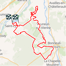
Trail Mountain bike of 48 km to be discovered at New Aquitaine, Vienne, Beaumont Saint-Cyr. This trail is proposed by kipoura.
Description
Un circuit d'environ 50 kilomètres vraiment superbe, tout y est pour se faire plaisir en VTT .... http://zevtt.free.fr
Positioning
Country:
France
Region :
New Aquitaine
Department/Province :
Vienne
Municipality :
Beaumont Saint-Cyr
Location:
Saint-Cyr
Start:(Dec)
Start:(UTM)
305671 ; 5177416 (31T) N.
Comments